Recovering Deschutes Basin Steelhead — Part 2
By Alex Hardison, Communications Manager
From humble freshwater beginnings, these fish become renowned aquatic pilgrims, embarking on a remarkable journey of ancient migration to the Pacific Ocean and back again over the course of their lives.
The steelhead trout is one of the Pacific Northwest’s most iconic species of fish. Historically, thriving steelhead populations were present throughout the Deschutes Basin, where these fish carry significant ecological, economic, and cultural values. But in less than a century, the impacts of irrigation, hydropower projects, and other human activities have disrupted the natural water systems and conditions that sustained them for millennia. With severely altered habitat and new challenges to migration, steelhead populations have fallen dramatically.
In this series, we’re exploring the history of steelhead in the Deschutes Basin, the impacts irrigation and development have had on their habitat, the actions water managers and regulators are proposing to address threats to this species, and whether they go far enough to restore the critical habitat steelhead need and deserve.
Ghostwaters
Nestled above an out-of-the-way river valley at the foot of the Ochoco Mountains toward the eastern extent of Crook County, Paulina Creek flows softly into Beaver Creek. Downstream, towering cut banks flanked by irrigated fields on both sides illustrate how the valley’s residents have harnessed these tributaries to cultivate an agricultural reality that was once alien to the landscape. Further down, Beaver Creek converges with the South Fork Crooked River to become the mainstem Crooked River — the central artery of the Ochocos that drains water from an area of approximately 4,500 square miles and carries it west toward the heart of the Deschutes Basin.
Not even a lifetime ago, things looked very different here. Standing deep in this overlooked corner of the high desert, it can be hard to believe that massive steelhead swam here, en route to spawning grounds even further upstream, as recently as the 1950s.
Biologist holding an adult steelhead caught in a fish trap on Paulina Creek in the 1950s. Source: ODFW
Deschutes steelhead. Illustration: Joseph Tomelleri
Steelhead trout (Oncorhynchus mykiss) are highly adaptable and remarkably resilient, and were once prolific inhabitants of nearly every reach and tributary of the Crooked River, Whychus Creek, and the Deschutes River up to Big Falls. Regional Tribes have depended on steelhead as a First Food for millennia, and these fish continue to hold considerable ecological, economic, and cultural significance for communities in Central Oregon and across the Pacific Northwest.
However, the introduction of irrigation infrastructure to withdraw and appropriate water from these rivers — especially over the past 100 years — has led to the extensive deterioration of historical habitat conditions that once sustained abundant steelhead populations. As a result, these aquatic icons have been extirpated from entire sections of the Upper Deschutes Basin, and their numbers have fallen dramatically.
What started as hand-dug ditches and small diversion dams following the arrival of white settler colonizers in the mid-1800s soon turned into the formation of irrigation districts and the near-total dewatering of rivers. By 1913, all surface water in the Deschutes Basin was over-allocated, and attempts to control stretches of riverine landscape by channelizing, berming, and damming streams further degraded habitat and water quality. Today, substantial basin-wide water withdrawals across eight regional irrigation districts from April to October each year continue to significantly reduce flows and increase water temperatures.
In the 1960s, construction of the Pelton Round Butte hydroelectric project created Lake Billy Chinook and fully blocked steelhead migration to the Upper Basin. The three-dam complex divided the Basin into Upper and Lower sections, severing volitional passage to hundreds of miles of critical habitat and spawning grounds for anadromous fish.
Round Butte Dam, completed in 1964, (the uppermost of the three dams) blocked anadromous fish runs to the Upper Deschutes Basin — including the Crooked River and Whychus Creek.
Reintroduction efforts for steelhead and salmon are underway, facilitated by two-way “trap-and-haul” operations that transport migrating salmonids by truck above and below the Pelton Round Butte dam complex. But water quantity, quality, and associated habitat conditions throughout the Upper Basin pose significant obstacles for upstream survival, spawning success, and overall population recovery.
In order to take steps toward recovering steelhead habitat and populations, it is important to better understand how we’ve fundamentally disrupted the waterways and environmental conditions that previously sustained steelhead throughout the Deschutes Basin.
The Crooked River during a period of low flows. Photo: Ryder Redfield
Of Dams & Diversions
A Crooked River or Canal?
From its headwaters, the Crooked River charts its course through distinct geologic formations, carving out deep river gorges and bisecting thousands of acres of irrigated agricultural land that wouldn’t exist without the river’s water. Wide valleys give way to dramatic canyons and vice versa in a game of landscape leapfrog as the waters descend toward a rendezvous with the Deschutes and Metolius in Lake Billy Chinook.
Twenty miles upstream of Prineville, the Crooked’s meandering journey slows to a crawl at Arthur R. Bowman Dam. And if the river itself slows substantially at Bowman, anadromous species like steelhead come to a screeching halt below the earthfill behemoth when migrating upstream.
Like Pelton and Round Butte Dams, Bowman was built in the late 1950s and early 1960s, at the height of a dam-building frenzy that epitomized water management across the Western United States, often at the expense of fish species. Unlike the Pelton Round Butte complex and other notable dams that have created barriers to migration on the Columbia, Snake, and (until recently) Klamath rivers, Bowman does not produce hydroelectric power. Its primary purposes are flood control and irrigation water storage in Prineville Reservoir, as well as modulating flows throughout the year to fulfill irrigation needs across the Lower Crooked River Basin. Without any fish passage infrastructure, the dam is the upstream limit to migration in the Crooked River.
Bowman Dam rises nearly 250 feet from the bottom of Crooked River Canyon to hold back the almost 150,000 acre-feet of water that forms Prineville Reservoir.
“Historically, there was another 500 miles of the river system above here that was potentially anadromous fish habitat. Steelhead were found 120 miles up into the Beaver Creek and Paulina Creek systems — and further.”
Amy Stuart was the first woman to ascend to the position of district fish biologist within the Oregon Department of Fish and Wildlife (ODFW). She spent over three decades working on the Crooked River, authoring studies that established important baseline information about fish populations in the river system — including the native redband trout, the resident form of steelhead — crucial for informed management decision making. As such, Amy knows the Crooked River better than just about anybody.

Former ODFW Prineville District fish biologist and Deschutes Basin Watershed Manager, Amy Stuart (with her Brittany Spaniels, Ruby & Riley) on the Crooked River.

Bowman Dam has disrupted the natural flow regime of the Crooked River that steelhead and salmon depend on throughout various stages of life.
According to Amy, Bowman Dam has created a ‘reverse hydrology’ from what’s normal.
“In a normal river — especially a snowmelt dominated system like the Crooked — flows naturally peak in the spring and drop during the summer,” she said.
“But this reach from the dam to where the Ochoco Irrigation District canals start taking water out of the river is managed to provide irrigation flows for the entire Lower Crooked River Basin. So in the summer, when you’d expect flows to be low, they’re actually quite high in the reach from the dam to the OID canal. And during the winter, flows drop to unnaturally low levels as water is stored in Prineville Reservoir. Below the diversions, the river experiences extreme low flows that cause chronic and acute mortality.”
"When you think about what the Crooked River looks like in August and September in the reaches below Prineville, it’s not good. It’s low flows, very hot, very turbid, loaded with toxins, and algae." — Amy Stuart
Below Bowman Dam, the Crooked River flows unperturbed through 8 miles of designated Wild and Scenic canyonland, sporting a renowned redband trout “tailrace” (or “tail water”) fishery that attracts seasoned fly-tying anglers and first-time casters alike. The water released from Bowman is drawn from the bottom of Prineville Reservoir, which keeps flows in this section of river artificially cold and favorable for fish during parts of the year when the Bureau of Reclamation releases the bulk of the stored irrigation water. However, the cooler summer stream temperatures immediately below the dam cannot compensate for the negative effects of irrigation activity, which leaves fish with the wrong amount of water, in the wrong places, at the wrong times.
When Amy first sampled the river in 1988, her team came up with a rough estimate of the upper reach below the dam where the most abundant fish populations are — around 800 trout over 8 inches in length per mile.
However, Amy noted that “when you go below the irrigation withdrawals — especially the big Ochoco Irrigation District diversion — the water starts coming out of the river, and it keeps coming out. From the OID canal downstream to Prineville and on to Smith Rock State Park, more and more water is progressively withdrawn. These irrigation withdrawals alter flows and create higher downstream water temperatures through the summer, which impacts fish life histories and leads to either acute or chronic survival issues.”
ODFW analysis has determined that a streamflow rate of 140 cubic feet per second (cfs) in the Lower Crooked River could achieve maximum habitat value for juvenile steelhead and be optimal for most life stages of steelhead, Chinook salmon, and resident redband trout.
That's a far cry from reality.
Legally, the Bureau of Reclamation is only required to release 10 cfs from Bowman Dam for the benefit of fish and wildlife during the irrigation season; this type of low flow event has occurred as recently as 2022, stranding fish and creating lethally hot conditions. Even outside these low flow events, temperatures on the Crooked below irrigation diversions create an existential obstacle for steelhead in the Deschutes Basin.
Converging with the mainstem Crooked in Prineville, the northern principal tributaries of Ochoco and McKay creeks — like almost all other streams in the Crooked River Basin — have also been reduced to glorified irrigation ditches with scant anadromous fish habitat.
“Ochoco Dam was finished in 1921, and the stream had already been over-appropriated,” Amy explained. “The dam was originally lower, and steelhead could supposedly swim over it during high-flow years. But in 1949 and 1950, they rebuilt the dam and raised its height, making it no longer passable.”
Downstream of the confluence of Ochoco and McKay Creeks, things don’t get much better for steelhead. In the reach above Smith Rock State Park, the Crooked runs through pastureland, irrigated agricultural fields, and rural developments. During the 1960s, this section of the river was straightened and diked to improve flood control, causing water to move through the streambed too quickly and eliminating complex instream structure that fish depend on for habitat. Combine that with agricultural runoff and additional diversions for Ochoco, North Unit, and Lone Pine irrigation districts, and the Lower Crooked is an unmitigated disaster for steelhead and salmon.
A stark transformation, especially considering the Crooked River was once the breadbasket of the entire Upper Deschutes Basin.
“I talked to some of the old timers back in the early 1990s who remembered seeing Chinook and steelhead spawning in Ochoco Creek up toward the forest boundary,” Amy recalled from her time as an ODFW fish biologist. “There were probably 700 miles, at least, of historical anadromous fish habitat throughout the Crooked River Basin. Now we’re lucky if we can call it 105 miles.”
A young Central Oregonian having a big day on Ochoco Creek in 1905. Source: Steve Lent, Bowman Museum
The Crooked River meandering through Prineville Valley circa 1903. Source: Steve Lent, Bowman Museum
ODFW's notice describing the loss of steelhead from the Crooked River and ongoing efforts to bring them back.
Today, an ODFW informational sign at Big Bend campground below Bowman describes the loss of steelhead from the Crooked River in the 1960s following the construction of the Pelton Round Butte complex. The sign alludes to recent reintroduction efforts and notes in bold: “it is unlawful to harvest steelhead in the Crooked River, and if caught, anglers should minimize stress to the fish by keeping them in the water and releasing them immediately.”
It’s a well-intentioned message, but consider that theoretical steelhead’s journey for just a moment.
For reintroduced adult Deschutes steelhead to reach that point, they would need to: make it upstream from the Columbia River to the Pelton Round Butte Project, be collected in the facility’s fish trap, get trucked above the three dams, be successfully released into Lake Billy Chinook, navigate the reservoir’s discombobulating currents, and find the mouth of the Crooked River. Then, after they’ve made it up the fish ladder at Opal Springs Dam, they could begin the homestretch of their migratory path.
“It’s all about irrigation. It’s not about fish. The river is essentially managed as a big drainage ditch, and flows are based on calls for irrigation. The fact that we have a tailrace fishery is because there’s at least a minimum flow from Bowman Dam down to the Ochoco Irrigation District Canal, but it’s not guaranteed below that. It’s a river, but it’s an irrigation system.”
This 16-inch redband trout mortality was observed in the Upper Crooked River near Chimney Rock on September 23, 2022 — when flows were at a paltry 10 cfs. Photo: ODFW
Upper Whychus Creek charts its course through eastern Cascade foothills.
Dry Run
The Dewatering of Whychus Creek
Engulfed by the Central Cascade cirque of Broken Top and the Three Sisters to the west, Whychus Creek drains over 250 square miles along the eastern slope of the Cascades and runs 41 miles north to its confluence with the Deschutes River just upstream of Lake Billy Chinook. Like the Crooked River, its flows are predominantly driven by runoff from headwater snow and glacial melt.
Historically, Whychus Creek provided an estimated 42 percent of steelhead spawning habitat in the Upper Deschutes Basin. Its natural combination of mixed streambed composition, complex floodplain, cool waters, and shaded pools made for prime steelhead spawning and rearing conditions — all the way to the 70-foot tall natural barrier of Chush Falls, at an elevation of nearly 5,000 feet.
Whychus Creek flows from its headwaters in the Cascades to its confluence with the Deschutes River just upstream from Lake Billy Chinook.
Unfortunately, for the better part of 150 years, water withdrawals and damming rendered this historical habitat unusable and inaccessible — and though some progress has been made, much remains. The first irrigation diversion in the entire Deschutes Basin was on Whychus Creek in 1871, and flows near Sisters were diverted entirely for irrigation by 1912. In fact, Whychus Creek was so heavily dewatered for irrigation that portions of the creek ran dry two out of every three years from 1960 to 1999. Combined with straightening and berming for flood control — which eliminated the complex channel structures fish depend on — Whychus, too, has functionally been a snowmelt-fed irrigation ditch since the early years of Oregon’s statehood.

Tod Heisler, Central Oregon LandWatch's Rivers Advocate.

Irrigation withdrawals used to leave sections of Whychus Creek dry during the summer.
Tod Heisler has spent decades studying how irrigation practices and flood control have degraded Whychus Creek’s once-ideal steelhead habitat. After leading the Deschutes River Conservancy for 15 years, Tod joined LandWatch to advocate for water policy reform and river restoration across the Deschutes Basin. His understanding of the creek’s human history is rich and vast, and he’s clear-eyed about the dire state of conditions for anadromous fish in Whychus.
“In the late 19th and early 20th century, Whychus Creek was dewatered. The state water master’s job and the irrigation district manager’s job was to dry up the creek.”
According to Tod, the theory embraced by water managers was that if there were flows left below the diversion, they were not doing their job — because the irrigation district has rights to the entire creek.
“That’s how it went for many, many decades. The psychology of it was really bad. So, you can imagine what happens to the fishery when you take all the water out pretty high up in the system,” he said.
This history — and its ecological consequences — are well-understood, and for nearly 30 years a consortium of local partners has worked to return Whychus Creek to some semblance of function. These partners, including Upper Deschutes Watershed Council, Deschutes River Conservancy, and Deschutes Land Trust, have restored habitat by removing dams, reconnecting the floodplain, planting native vegetation, and putting some water back instream. Meanwhile, Three Sisters Irrigation District (TSID), which controls water delivery during the irrigation season, has piped enough of its canals and allowed enough instream transfers and leases to return roughly 15 cfs to the creek. But while irrigation infrastructure modernization and collaborative water conservation work on Whychus has recovered sufficient flow that the creek no longer runs dry, streamflow continues to fall well short of meeting the needs of steelhead.
“Most people don’t understand the needs of fish. They might look at a creek and say: ‘What’s wrong? There’s water in it, why aren’t you satisfied?’,” Tod exclaimed. “But we don’t have the quantity nor the quality of water instream yet to support the fishery as it needs.”
“We believe that there is a strategy that gets us there where we’re not depriving irrigators of all their water. It’s not a zero-sum game here. We can continue to implement projects and transactions that will help the creek and move it to some place that is sufficient — it’s never going to be perfect for steelhead — but sufficient for their needs while still providing water to irrigation district patrons.”
Three Sisters Irrigation District diverts water from Whychus Creek a few miles upstream from Sisters.
Whychus does have a relatively senior instream water right of a little more than 30 cfs, meaning the creek has a state-recognized right to water. However, due to seasonal shortfalls in most years, irrigators with more senior water rights have priority in times of water scarcity. This leads to lower streamflows in Whychus and lethally-high water temperatures for fish during the summer months, a crucial time for rearing steelhead that need to spend one to two years in Whychus before out-migrating.
Diversion of large portions of streamflow dramatically exacerbates this seasonal warming trend. TSID is legally allowed to drop flows down to around 20 cfs, but modeling indicates that steelhead require triple that volume to maintain the cool water temperatures that rearing fish need to survive the hottest parts of the summer before smolts out-migrate from Whychus.
“We know that increased flow has, by far, the biggest effect on driving temperatures down — and a much greater impact than restoration projects. Roughly 80% of the effect that we’re looking for is generated by increasing flow rather than restoring habitat.”
The effort to restore Whychus Creek for anadromous fish has been long, complex, and often contentious, and the dedicated partnership working to transfer water instream, improve the creek’s hydrologic function, and remove passage barriers has made remarkable progress. These are critical pieces of the habitat puzzle, but they can’t succeed alone.
Because steelhead begin returning to the Deschutes Basin in summer and remain there for months before spawning the following spring, they depend on cold water and healthy habitat to survive the hot summer months.
Rewatering Refuge
Steelhead in the Upper Deschutes Basin have clear, well-understood needs.
Complex instream structure and riparian vegetation play a key role in promoting habitat quality by stabilizing stream morphology, keeping water temperatures cooler, and keeping more water on the landscape for greater periods of time.
They need cold, clean, well-oxygenated water with the right mix of streambed composition and low sedimentation for successful spawning and rearing. Like other anadromous fish, they need gravels, pools, fines, and large woody debris for habitat; they need channel complexity and sinuosity to slow the water down; they need a connected floodplain to keep water on the landscape for longer and to support native riparian vegetation. They need unimpeded access to extensive networks of natal spawning streams. And in runoff-dominated systems like the Crooked River and Whychus Creek, they need natural flow regimes to facilitate the cycle and timing of successful reproduction.
If steelhead’s needs are clear, it’s equally clear that irrigation diversions and dams are the root cause of their plight, and that the only viable solution is to keep more water in our rivers and streams. The question, then, is how to get there, especially as the pressures of climate change, persistent drought, and the escalating water demands of our growing communities converge.
For now, steelhead persist in parts of the Deschutes Basin. A powerful instinct compels them to overcome all odds so that they may return to their homewaters — fated to swim upstream in more ways than one.
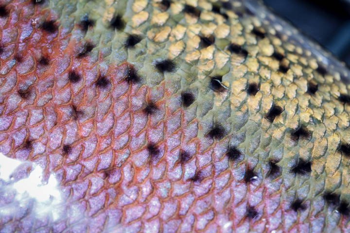
The vibrant hues and patterns of steelhead scales. Photo: Ryan Hagerty / USFWS
The steelhead saga continues…
We hope you enjoyed this second installment in our in-depth exploration of the current state of the Deschutes Basin steelhead. In Part Three of the series, we’ll explore what agencies and irrigation districts are doing to improve habitat for steelhead in Whychus Creek and the Crooked River — and whether it’s enough to meet the needs of the species.